

 with Famous Bucas Grande Tour!")


More areas were placed under Tropical Cyclone Wind Signal (TWCS) No. 2 as Tropical Storm Crising accelerated while moving west-northwestward toward the Davao Oriental-Surigao del Sur area, PAGASA said Thursday.
In its 2 p.m. severe weather bulletin, the weather agency said the following areas are under TCWS No. 2 and will experience a strong breeze to near gale conditions:
- The southern portion of Surigao del Sur (Lingig, City of Bislig)
- The southern portion of Agusan del Sur (Loreto, Trento, Bunawan, Santa Josefa, Veruela)
- The northern portion of Davao Oriental (Boston, Cateel, Baganga)
- The northern portion of Davao de Oro (Laak, Monkayo, Montevista, Compostela, New Bataan, Nabunturan, Mawab)
- The northern portion of Davao del Norte (Kapalong, San Isidro, Asuncion, New Corella, Talaingod)

Meanwhile, TCWS No. 1 is raised over the following areas, which will experience a strong breeze to near gale conditions:
- The rest of Surigao del Sur
- The rest of Agusan del Sur
- Agusan del Norte
- The rest of Davao Oriental
- The rest of Davao de Oro
- The rest of Davao del Norte
- Davao City
- Bukidnon
- Lanao del Sur
- Lanao del Norte
- Misamis Occidental
- Misamis Oriental
- Camiguin
- The eastern portion of Zamboanga del Sur (Josefina, Molave, Tambulig, Aurora)
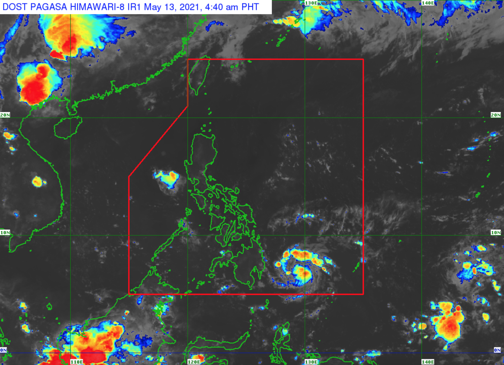
At 1 p.m. on Thursday, the center of Crising was estimated at 250 kilometers east of Davao City, Davao del Sur with maximum sustained winds of 65 kilometers per hour near the center and gustiness of up to 80 kph.

It is moving west-northwestward at 25 kph.
PAGASA said Crising is likely to make landfall over the Davao Oriental- Surigao del Sur area between Thursday night and early Friday morning.
Though slight intensification is likely, the weather agency said Crising is expected to remain as a tropical storm.
It may weaken into a tropical depression throughout Friday while traversing the landmass of Mindanao, PAGASA said.
Hazards on land, in coastal areas
According to PAGASA, moderate to heavy rains are expected over Surigao del Sur, Agusan del Sur, Davao Oriental, Davao de Oro, and Davao del Norte between Thursday and Friday.
“Under these conditions, isolated to scattered flooding (including flash floods) and rain-induced landslides are possible during heavy or prolonged rainfall,” the weather agency said.
Meanwhile, moderate to rough seas will prevail over the eastern seaboard of Mindanao in the next 24 hours.
“Mariners of small seacrafts are advised not to venture out over these waters. Inexperienced mariners of these vessels should avoid navigating in these conditions,” PAGASA said.
The next severe weather bulletin on Crising will be issued at 5 p.m.
Meanwhile, Armando Gomez of the Agusan del Sur PDRMMO said their search and rescue units, as well as water assets, have already been pre-positioned.
“Tinitignan po natin ‘yung severity of this impact of disaster due to climate change [We are monitoring the impact of this disaster due to climate change],” he added.
Food and non-food items have also been delivered to preparedness areas of local government units, Gomez said.
The PDRRMO urged the public to listen to regional advisories as well as orders on preemptive evacuation. -Joahna Lei Casilao/MDM, GMA News
7 Easy Ways To Make Extra Money At Home


